

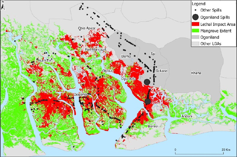
Satellite imagery clearly highlighting the two massive Bodo oil spills of 2008-2009 (the two big black dots). 4 of the 6 schools we support are within the “lethal impact area” in red on this map near those two big dots. Reprinted with permission from Christopher B. Obida, George A. Blackburn, James D. Whyatt and Kirk T. Semple, “Counting the Cost of the Niger Delta’s Largest Oil Spills: Satellite Remote Sensing Reveals Extensive Environmental Damage with >1 Million People in the Impact Zone,” Science of the Total Environment, Vol. 775, 25 June 2021, Article Number 145854.